Turn a list of breweries into a day worth remembering.
BrewTrails finds the breweries around you, sorts them into a route that actually
makes sense on foot, and keeps a record of every beer worth ordering again.
Find the breweries•Sort the route•Walk it•Check in•Rate the beer•Earn the patch•Bring your friends•Do it again somewhere new•
Try it without downloading anything
Pick the stops. Watch the route sort itself.
This is the job BrewTrails does, running in your browser on eight real Cleveland
breweries. Tap them in any order you like — the app works out a sensible one.
Your trail
Sorted for the shortest walk.
—Distance
—Between stops
Drawn map, approximate positions. The app uses the real ones.
How a day actually goes
Three screens, one afternoon.
1
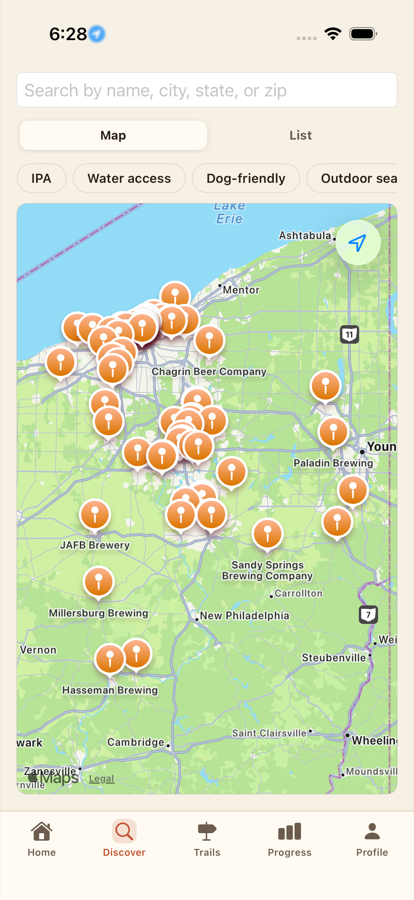
Find the ones worth the walk.
Search a city or open the map where you are. Filter down to what you
actually want out of the afternoon rather than scrolling a list of
every taproom within thirty miles.
Dog-friendly, outdoor seating, water access, IPA on tap
Hours and tap lists kept current by the breweries themselves
Missing one? Add it, and you get a badge for putting it on the map
2
The route sorts itself. You just walk it.
Add your stops and BrewTrails puts them in an order that does not have you
crossing the river twice, with walking, driving and rideshare times between
each one. Invite friends and you plan it together, on the same trail.
Reorder anything by hand if you know better
Live travel mode while you are out
A ride is one tap away from every stop
3
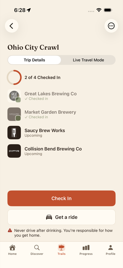
Remember what you actually drank.
Check in at each stop, rate what you had, add a photo and a note. The trail
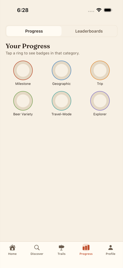
fills in behind you — and six categories of badges keep score of the places,
the styles and the states you have covered.
Your ratings stay yours — breweries see the words, never the name
Anything you skipped comes back so you can finish it
Follow friends and see where they have been
Twenty-seven of them, and counting
Proof you went.
Every badge is its own piece of embroidered artwork, and every one marks
something you actually did rather than something you meant to do.
Century Club100 breweries checked into50 States VisitedNothing left to proveRoad TripperA trail across more than one dayIPA EnthusiastFifteen of them, ratedKayak CrawlerPaddled to a brewery. Genuinely.First to Check InBefore anyone else got thereLocal LegendThey know your orderBetter TogetherA trail finished with friends
0badges in the app today, each with its own artwork
0categories — milestone, geographic, trip, style, travel, explorer
$0to download, and to keep using
Coming to Canada
Canada, you’re next.
Yeast Van. The Barley Belt. Mile End. Quidi Vidi. You have already
named your brewery districts — you just have nothing that plans
the walk between them. That is a trail-shaped hole, and we would
very much like to fill it.
VictoriaBC · Rock Baystart
VancouverBC · Yeast Van+110 km
CalgaryAB · Barley Belt+970 km
WinnipegMB · The Exchange+1,330 km
TorontoON · The Junction+2,100 km
OttawaON · Hintonburg+450 km
MontréalQC · Mile End+200 km
HalifaxNS · The North End+1,250 km
St. John’sNL · Quidi Vidi+1,500 km
0stops, Pacific to Atlantic
0of road between the first and the last
0provinces — and it still misses three, plus every territory
What actually stands in the way, since you will ask.
The brewery data comes from Open Brewery DB, and our importer asks it for
by_country=united_states — Canada is one parameter on one
line. The real work is the rest: the geographic badges count US states, so
provinces need their own set, and a trail measured in miles is no use to
anyone in Victoria. We would rather show you this list than a launch date
we have not earned.
BrewTrails is 21+. The app does not measure how much you have had and cannot
tell you whether you are safe to drive. Never drive after drinking — how you get home is
your responsibility. Every trail screen keeps a ride one tap away for exactly this reason.
If you make the beer
Claiming your listing is free, and takes about a day.
Brewery data comes from public sources and goes stale. Yours will not.
Keep your details right
Hours, phone, website, amenities — corrected once and then yours to maintain.
Publish your tap list
Approve what visitors suggest, or add beers yourself. Your list, worded your way.
Read your check-ins
See what visitors said and reply. Names are never shown — feedback without a public review thread.
Somewhere near you, four good breweries are within a mile of each other.
BrewTrails is free, it is for iPhone, and it is nearly ready.
Coming soon to theApp Store
No launch date we can promise yet — we would rather say that than invent one.
Leave your email and we will send one message the day it lands. Nothing else.